

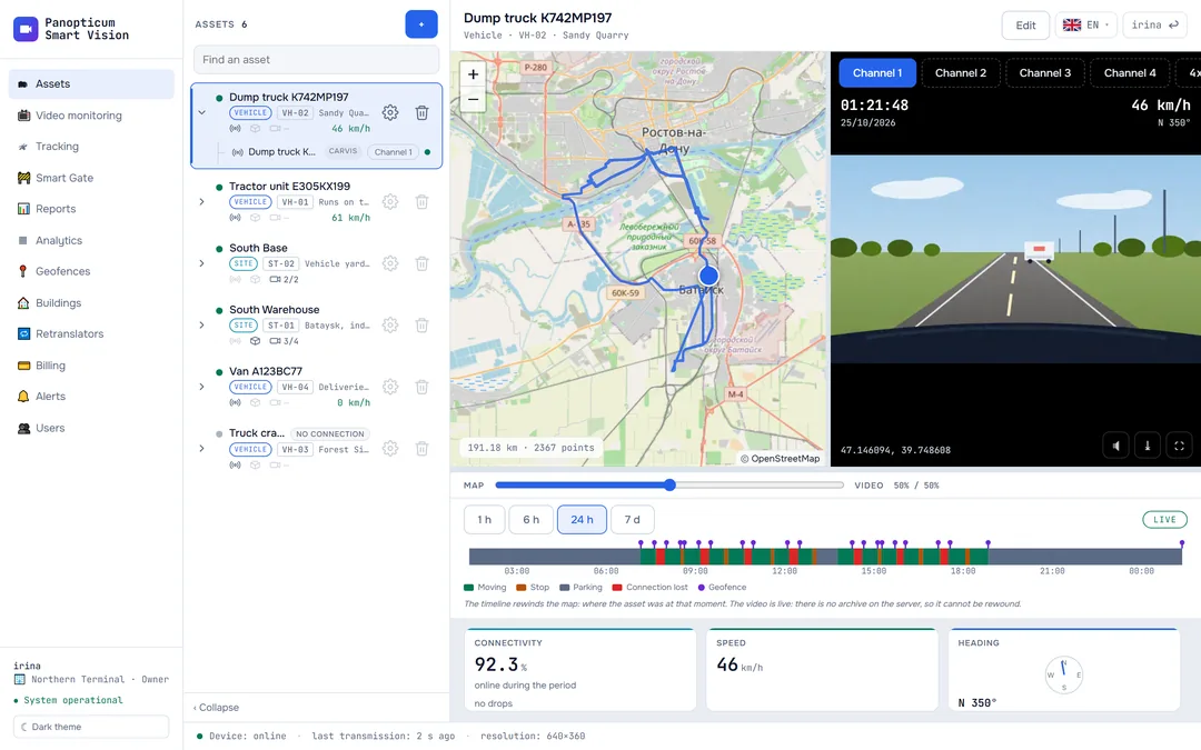
A geofence is an area on the map: a depot, a quarry, a construction site, a stretch of highway. The system watches when vehicles enter and leave it, whether they speed inside, stay too long or have not come in for a long time, and reports it to Telegram or by email.
The Geofences section
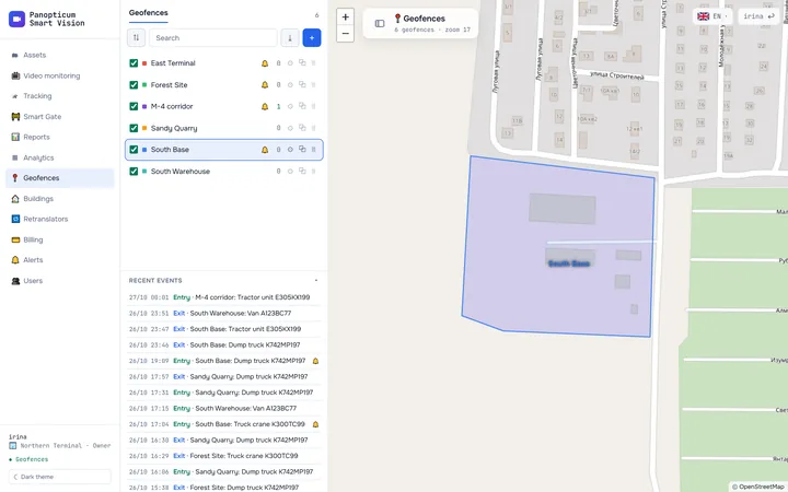
The list of zones is on the left, the map on the right. Clicking a row shows the zone on the map, the tick turns it on and off, and a bell means the zone has alerts turned on. At the bottom of the list there are the latest events: entries, exits, speeding and long stays.

- Zones: the tick turns one on, a click shows it on the map
- New zone
- Latest entries and exits
The arrow button next to the search exports all zones as a GeoJSON file: other mapping programs open it.
Types of zones
| Type | How it is drawn | What for |
|---|---|---|
| Polygon | By clicking the corners of the area | A depot, a warehouse, a quarry, a construction site |
| Line | By clicking along a road, with the corridor width in metres | A stretch of highway, a route |
| Circle | A click in the centre and a radius in metres | A point with a margin around it: a filling station, a loading point |
How to draw a zone

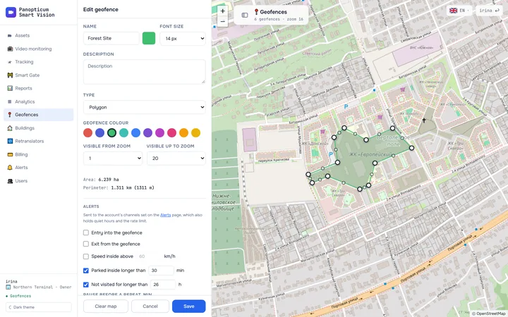
- The zone’s name, type, alerts and devices
- The area and perimeter are calculated at once
- Press + above the list, enter a name and choose the type.
- Click the map at the corners of the area. Clicking the first point or pressing Enter closes the outline, Esc cancels the drawing, Backspace removes the last point placed.
- Vertices can be dragged. The small circle in the middle of a side turns into a new vertex when you pull it. Clicking a vertex with the Alt key held removes it.
- The area and the perimeter are calculated straight away, while you draw.
- The colour, the caption size and the zoom levels at which the zone is visible on the map are set in the same form.
When the outline is ready, press “Save”. “Clear map” erases what has been drawn, “Cancel” leaves without saving.
1Open Geofences and press “+”.
2Enter the zone’s name.
3Click the map at the corners of the area; clicking the first point closes the outline. You can drag the vertices.
4Tick what to report: entry, exit, speed, parking or a long absence.
5Press “Save”.
Zone alerts
In the zone form, tick what to report:
- Entry into the geofence and exit from the geofence;
- Speed inside above a set value, for example 60 km/h;
- Parked inside longer than a set number of minutes;
- Not visited for longer than a set number of hours: the vehicle has not been to the depot for a long time.
Pause before a repeat keeps the same event for the same vehicle from arriving more often than once in that many minutes. In the “Devices” block you can tick which vehicles to watch; if nothing is ticked, the zone watches all the account’s devices.
The messages go to the channels of the Alerts section, and the quiet hours and the hourly message limit work there too: Alerts.
Why a vehicle at the boundary does not send a hundred messages
An entry counts as soon as the vehicle is inside the zone, but an exit only once it has gone 50 metres beyond the boundary. The coordinates of a standing vehicle jitter by tens of metres; without such a margin, a vehicle parked right at the boundary would ‘enter’ and ‘leave’ every minute.
- Entry counts at once, as soon as the vehicle is inside the zone.
- The vehicle stands at the boundary. Its coordinates jitter by tens of metres, and without a margin every jitter would become a Telegram message.
- Exit counts only once the vehicle has gone 50 m beyond the boundary.
- Result: two events instead of a dozen.
Where else zones are visible
- On the Tracking and Assets maps, the zones are drawn over the map.
- Reports have the “Geofences”, “Trips between geofences” and “Missed geofences” tables, and the “Location” column is labelled with the zone’s name: Report tables and charts.
In the apps
Web
Everything described above.
Windows
The Geofences section with the same drawing, alerts and choice of devices. The map here is moved with the left mouse button, so a vertex is placed only by a click without dragging.
Android
A list of zones, viewing them on the map and a zone editor with touches.
Telegram
In the Telegram panel, Geofences open from the More menu: the list, the map and editing a zone.
If it did not work
- The messages do not arrive. Check that the zone has the right events ticked, that Telegram or email is connected in Alerts and that it is not the quiet hours right now.
- The track shows the vehicle entering, but there was no message. If the device was uploading its stored history at the time, no events are sent for it: otherwise a month of history would turn into a month of messages. Such visits are shown in the “Geofences” report.
See also
Found a mistake, or didn’t find an answer? Write to us on Telegram or send us a request, and we will reply and fix the article.